Feb 3, 2021
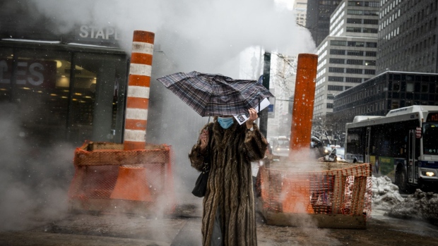
Chill of the Season to Make U.S. Shiver From Chicago to New York
, Bloomberg News

(Bloomberg) -- The coldest stab of the season is about to strike the central U.S.
A snowstorm is expected to roar through the Midwest starting Wednesday night, followed by biting cold over the next few days that will drag temperatures in Chicago down to minus 1 Fahrenheit (minus 18 Celsius) by Saturday. Milwaukee will reach minus 7 and Minneapolis will hit minus 14 before the chills shift to New York and the Northeast next week, the National Weather Service said.
The cold snap comes after the air high above the Arctic began to warm last month. The weather pattern, called a sudden stratospheric warming, is usually followed by a weakening of the polar vortex, the girdle of wind that keeps cold bottled up at the North Pole. When that happens, frigid air can spill south into North America, Asia and Europe. It’s the same pattern that plunged temperatures in Chicago to minus 16 in 2014, though this year probably won’t be as bad.
“It is a cold air mass, probably the coldest of the season,” said Lara Pagano, a forecaster at the U.S. Weather Prediction Center. “It’s going to be bitterly cold.”
While temperatures will tumble as Arctic air spills into the Great Plains and Midwest, it’s unlikely to be a cold snap that earns a place in the record books. There will be some wild temperature fluctuations, but “there are only a handful of places tying or breaking records,” she said.
‘Arctic Front’
Still, frigid temperatures across the U.S. for the next two weeks will likely drive up demand for electricity and natural gas to warm homes and businesses. Temperatures will drop as much as 8 to 15 degrees below normal across broad swaths of the Great Plains, Midwest and Northeast through February 12, with cold lingering 5 to 8 degrees below normal until February 17, Matt Rogers, president of Commodity Weather Group LLC, said in a note to clients.
“There remains good model agreement of a cold prevailing pattern over the next two weeks, especially behind an Arctic front this weekend,” Rogers said.
The chill follows a record-breaking snowstorm that buried New York City and the Northeast this week, tying up road, rail, and air transportation across the region. Manhattan’s Central Park more than doubled its seasonal snowfall totals, going from being below normal to more than a foot above.
The official total for the storm was 17.2 inches in Central Park, down from earlier reports of 19.3 inches, making it the 16th most potent storm since 1869, according to the Weather Service. The No. 1 spot goes to a January 2016 blizzard that dumped 27.5 inches of snow.
Nazareth, Pennsylvania, got the most snow in the region this week with 36.1 inches, while Mount Arlington’s 35.5 inches was the most in New Jersey and Fishkill’s 25.6 inches topped the New York state total, the Weather Prediction Center said.
Another winter storm is already sweeping across the Great Plains and Midwest, setting off blizzard warnings in Iowa and a winter storm watch across the upper Midwest, the Weather Service said. Chicago could pick up an inch of snow as well as some rain through Friday.Along the East Coast, there’s a chance of rain and snow this weekend, Pagano said, “but nothing like we just saw.”
©2021 Bloomberg L.P.


