Dec 22, 2022
Extreme Cold Grips US as Jet Stream Bends Under Climate Change
, Bloomberg News

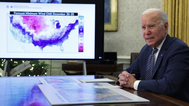
(Bloomberg) -- An extreme dive by the jet stream across North America is driving the wedge of cold air deep into the heart of the US and pushing temperatures below freezing right down to the shores of the Gulf of Mexico. It’s the kind of event that could become more common as climate change accelerates.
The signs of a sudden shift in the jet stream can be seen in Thursday’s temperatures and its forecasts. The low in Montana reached minus 50F (-45.6C), according to the US Weather Prediction Center. The high of 33F in Chicago was expected to drop to minus -6F overnight. New York’s Central Park will swing from 53F on Friday afternoon to 14F within hours, while in Dallas Thursday’s high of 44F is forecast to drop to 11F. Thousands of flights have already been canceled at one of the busiest travel times of the year.
The force behind this deep freeze is cold conveyed from the Arctic by the jet stream, a ribbon of high winds that girdle the globe. “With weather this bonkers, you can bet your bottom dollar that it’s because the jet stream is loopier than usual,” said Jennifer Francis, a senior scientist at the Woodwell Climate Research Center in Falmouth, Massachusetts.
These sharp kinks in the jet streams are a hallmark of the changing climate, much like extreme weather disasters such as droughts, floods and heat waves. Last summer another sharp bend in the jet stream caused record heat to sear across Washington state and Oregon while it pumped cooler air into the central US, bringing ruinous flooding to Missouri and Kentucky.
The pre-Christmas freeze in the US is one of the more powerful examples of a December kinked jet stream, said Jeff Masters, a meteorologist for Yale Climate Connections. To find a prior example would mean looking back as far as December 1983. The stunning thing about this week’s cold is that it’s coming during a relatively mild season so far.
“An event like this can occur naturally,” Masters said. “But with the disruption of global weather patterns that climate change is bringing, the probability of seeing unusual weather events in any season increases.”
The jet stream’s delivery of the cold straight from the Arctic is also providing half of the fuel the winter storm crossing the US will need to explode into a meteorological bomb cyclone. The other half is the abnormally warm moist air coming up from the Gulf of Mexico, which like the Atlantic as a whole is “running a fever,” Francis said. “Those huge temperature contrasts are the stuff bomb cyclones are made of.”
The storm will hurl gusts up to 45 miles per hour at Chicago late Thursday, according to the National Weather Service. Boston is forecast to get gusts of 65 mph Friday, New York 48 mph, and Portland, Maine, could reach 70 mph — enough to knock down tree limbs and cause widespread outages.
It will also blow a heavy storm surge into coastal New England just as tides are at their highest because of the new moon. Masters warned that Portland could also see some of its highest storm surge tides since 1978, when a massive blizzard buried the Northeast under feet of snow — all thanks to an unusually sharp bend in the jet stream.
©2022 Bloomberg L.P.


