Feb 19, 2024
California Faces New Flood Risk, Potential Tornadoes
, Bloomberg News

(Bloomberg) -- This is from the Green Daily newsletter. Sign up to receive it in your inbox.
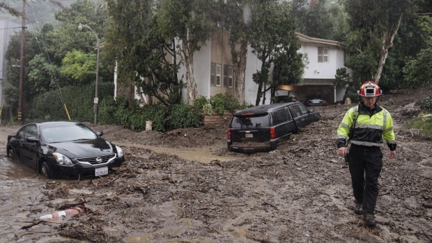
A category 2 atmospheric river is unspooling across California, according to the Center for Western Weather and Water Extremes, bringing the risk of severe thunderstorms — including tornadoes — in the state’s Central Valley, including Sacramento, Stockton, Modesto and Roseville.
The storm may also bring new flooding concerns for areas around Los Angeles and San Diego. The National Weather Service forecasts two to five inches (5.1 cm to 12.7 cm) of rain through Wednesday morning — and up to 8 inches in the mountains. As much as three feet of snow is possible in elevations exceeding 7,500 feet.
For central parts of the state, the greatest risk of an “isolated tornado” is Monday afternoon and night, the US Storm Prediction Center said. There is a flood warning up across the Central Valley to the coast north of the Bay Area. In addition there are wide areas under high wind warnings and deep snow is forecast for the Sierra Nevada. Avalanches are likely.
In other weather news:
US: From Feb. 24 to 28, the odds are high that the central US, including Chicago, St. Louis, Dallas and Houston, will be warmer than normal, according to the Climate Prediction Center. The East Coast will be seasonal and the West Coast a touch colder than normal. The warmth will likely spread to the East Coast, including New York City, from Feb. 26 to March 3, according to the agency.
Jet stream: On Feb. 17, the National Weather Service office in Washington-Baltimore recorded its second strongest upper level wind. A weather balloon between 34,000 to 35,000 feet encountered winds of 265 miles per hour (426 km per hour), according to a social media post. This year the jet stream has unleashed some harsh weather in Europe. Winter storms Isha and Jocelyn, benefited from the boost.
Australia: Northern Australia is seeing rain and floods along the path of ex-tropical cyclone Lincoln, Miriam Bradbury, a forecaster with the Australian Bureau of Meteorology said. There is a chance Lincoln could re-intensify into a tropical cyclone late this week. The storm is currently centered over the Western Australia-Northern Territory border and dragging in moisture from the tropics, she said. By Thursday, it will go back out over the Indian Ocean. As it does it will run down the Kimberley Coast and this could lead to a second landfall at cyclone strength this weekend. Meanwhile, across Western Australia record heat continues. All-time records were set in Carnarvon — 49.9C — and Shark Bay — 49.8C, said Dean Narramore, a forecaster with the bureau.
©2024 Bloomberg L.P.


